Project Update: Sowing spring barley seed using variable rate at Pantyderi, Demonstration Site
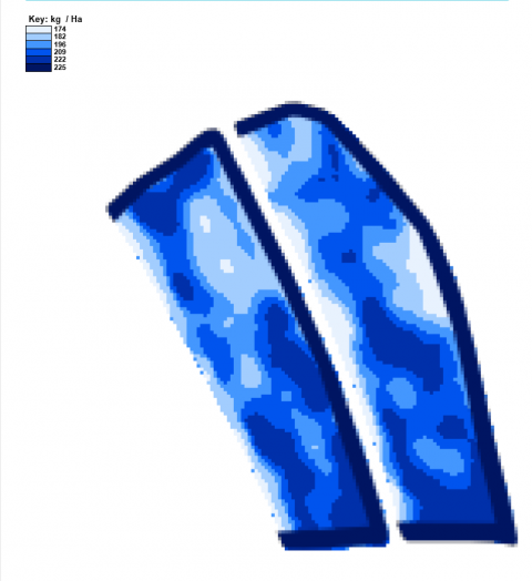
Soil mapping by Electrical Conductivity (EC) scanning has been carried out on 60ha of cereal growing land at Pantyderi. This process maps precisely how soil properties vary across a field and fields can be subdivided into management zones on this basis. Strategic soil sampling of these zones then creates a more detailed picture which can be used to inform variable rate lime, fertiliser and seed sowing rates.
Using the soil mapping information for growing a crop of spring barley will be demonstrated in a trial using two adjacent fields of the same size and similar soil type variation, but managing one on a flat rate basis for all inputs and the other on a variable rate basis. This will feature sowing using a variable seed rate where the poorer soil type or problem areas of the field will receive higher seed rates to potentially even out crop yields across the field. Digital maps (shown below) will be provided to the sowing contractor on a plug-in stick which connects through the tractor’s GPS system control panel to inform a variable sowing rate drill. Any crop development differences between the two fields will be monitored through the growth stages, culminating in a comparison of combinable crop yields at harvest.
Click here to view the project introduction.