8 July 2022
Dr David Cutress: IBERS, Aberystwyth University.
- Biodiversity contributes unseen benefits and is essential for a sustainable future
- Traditional biodiversity evaluation is time consuming, costly and difficult to scale up
- Technologies could help to collate and automate biodiversity evaluation
- Such tools could improve biodiversity focused landscape management practices
Importance of biodiversity
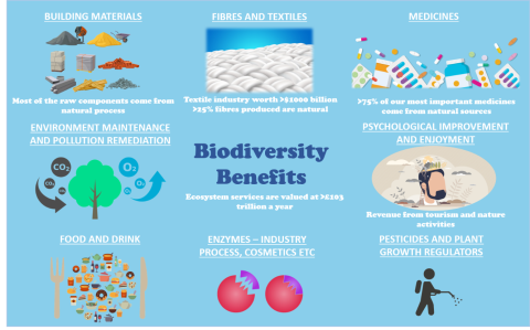
Biodiversity is one of the most vital things for human survival and economic success. It provides us with a range of both direct and indirect benefits and ecosystem services without which we would perish due to lack of sufficient nutrient sources, amongst a range of other things as illustrated in the diagram below.
Biodiversity plays key roles in ecosystem functionality which in their part play key roles in vital biological cycles, such as the carbon cycle (facilitating the correct atmosphere for us to breathe and storage of carbon as an energy food source via photosynthesis), the water cycle and the nitrogen cycle. From as far back as the 80s, research has been evaluating data that suggests that the planet is undergoing a mass extinction phase, likely due to human impacts. Using fossil record data, we can observe that the rate of species extinctions is 1000’s if not 10,000’s times higher than it has been in the past. This is occurring not just with species we can see (macroscopic) but also with species we might otherwise not see (microscopic). Despite their diminutive size, these species play important roles in ecosystem functionality (such as rhizobia bacteria in nitrogen-fixing for crops and pastures). Maintaining and increasing biodiversity levels is essential as no single species survives in isolation, each is reliant on other species to facilitate different aspects of their survival. Systems are so complex that it is difficult for scientists to define at what point biodiversity losses could lead to ecosystem collapse. As such, to avoid ecosystem instability and potential collapse we should be doing all we can to improve biodiversity now.
It is vital that this is understood within the agricultural sector as essentially agriculture competes for land and space with biodiversity, making it a one of the largest contributors to biodiversity loss along with urbanisation and transport. Land cover changes alone have been estimated to cause losses of £3.5 – £16.5 trillion a year in reduced ecosystem services. Loss of biodiversity via agriculture is linked with active management, often involving the removal of native species in favour of crops and pastures with limited species diversity (often monocultures). Equally, management towards higher yields leads to ever-increasing compounds applied to landscapes, such as fertilisers, manure and pesticides which can pollute environments impacting local species diversity directly and indirectly. Recently, biodiversity has come to the forefront of many global agricultural agendas due to pressures surrounding sustainability and climate change. UK wide agricultural regulations and subsidies are set to focus on practices which reduce biodiversity losses in an attempt to combat the historic downward trend. This could act as an opportunity for farmers to be rewarded for taking active roles in improving systems, as increased value is being given to biodiversity within concepts such as natural capital and public goods. Whilst many farming strategies aim to reduce biodiversity loss (including regenerative agriculture, species-rich leys, wildflower strips, set aside land, hedgerows, cover crops and crop rotation for pollinators), these will not be directly discussed in this article. Instead, we will focus on determining what practices act beneficially toward biodiversity. In order to do this we need accurate ways of measuring biodiversity.
Agriculture has seen an increased uptake of cutting-edge precision technologies that can provide various benefits and allow data to be gathered 24/7 measuring several variables. Whilst technologies' main roles in the sector currently relate to monitoring and evaluating soils, crops and livestock, largely for productivity, they have also been suggested to have monitoring roles in the conservation of biodiversity.
Traditionally much of biodiversity analysis is reliant on direct observations and trapping performed by field workers, along with laboratory analysis of specific areas under investigation. These have issues regarding achievable sampling sizes, standardisation of measuring procedures, labour cost and time involved (along with the varying skill levels of individuals performing the evaluation impacting accuracy and subjectivity). So, we will explore how technologies may play a role in mitigating some of these issues in the future.
Remote Imagery and Biodiversity
To scope biodiversity on a large scale, collected data needs to encompass geographically large areas with ease. This has been achieved to various levels via earth observation using remote sensing tools incorporated into satellites, aircraft and unmanned aerial vehicles (UAVs). Remote sensing, amongst other roles, has been shown to have potential in evaluating species-environment interactions in combination with animal movement data. It also has potential in speciating trees in mixed forest ecosystems and significant potential in evaluating forest health, with roles in reducing biodiversity losses long term via analysis of spectral traits.
Imagery tools such as normalised difference vegetation index (NDVI), often used to evaluate crop yields remotely, can also be used to assess wild vegetation yields in order to evaluate plant success and biodiversity. NDVI can similarly help to map likely areas of forage for different invertebrates and other animal biodiversity implications.
Satellites
Remote sensing satellite imagery has the potential to provide consistent observation of large geographical areas over time. Importantly, remote sensing is a non-contact tool and performing analysis in this way doesn’t disturb species within an environment. Satellite remote sensing tools have been demonstrated to have potential in assessing wildlife forage/resource selection via LiDAR to assess population success or decline over time. It can also evaluate invasive plant species spread over time. Its limitation and issues arise from how long such data is stored in databases (to allow historic comparisons and analysis), how much the data costs to access and how easy or compatible the data is for extraction, analysis and manipulation. There are also some issues depending on the remote sensor used surrounding cloud cover impacting results.
UAVs
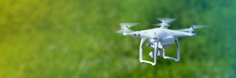
UAVs have repeatedly been reviewed to have significant potential in repeatable, low-cost biodiversity conservation applications. Many studies note that lower altitudes of UAVs achieve improved data over satellite imagery techniques but that the height that UAVs are flown requires further research to optimise the detection of biodiversity levels. In a review produced in 2020, it was shown that UAVs could be as successful as other methods of assessing biodiversity. Whilst there are some trade-offs in the precision and accuracy of the results achieved, compared to ground-based analysis, much larger areas are covered more quickly. Importantly, this review analysed simple red/green/blue (RGB) consumer-friendly UAV systems, which would provide far cheaper more accessible data than satellites.
Incorporating more complex imagery, such as infra-red, UV and multispectral systems on UAVs, may improve biodiversity monitoring potential significantly. For example, thermal imagery for plant phenotyping could not only help with monitoring stress levels of key plant species but could factor into future identification methodologies for determining biodiversity levels. UAV imaging for plant species diversity evaluation has been shown to have roles in evaluating invasive species and weeds, species diversity in difficult to assess areas (such as coastal cliffs) and mapping diversity in pastures. Plant diversity can also be used to evaluate invertebrate populations vital for ecosystem services.
Similarly, UAVs have been shown to have the potential for assessing soil health which can help in shaping practices to improve this vital resource for ecosystem management. UAVs also have significant potential for direct detection of animal species within an environment over larger areas, more quickly and less invasively than many other investigative tools. This could play roles in improving our understanding of habitats and ecosystems with fixed-wing systems having good potential for tracking larger species over open areas and multi-rotor systems having potential for smaller, elusive species. Combining the imagery capturing with algorithms and AI could lead to automated detection of species reducing the time and difficulty of surveys.
Other sensors and tools
Our smaller invertebrate species are also of concern due to their vital impacts on ecosystems via roles in pollination, decomposition and as invasive pests. Different camera trap systems are under development using object analysis to ID insects within traps. These systems work the same as traditional insect trapping where multiple sampling points of data can be combined for accurate representations of species abundance. Species abundance and composition can be used by experts/algorithms to make assumptions about the ecosystem functionality from the data. Of higher interest to farmers, pest species can also be identified and these could be incorporated into sustainable pest control options via integrated pest management and biological controls, or at least assist in more focused pesticide applications to reduce off-target biodiversity impacts. Similarly, acoustic sensors are being developed to determine insect, bird, amphibian and even bat species based on their noise profiles allowing the public to record sounds from their phones for automatic species identification for improved biodiversity reporting.
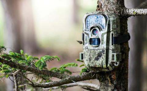
Other tools include utilising data from technologies such as ecological camera traps. Whilst camera traps are already a vital source of information for ecology and biodiversity evaluation, their analysis has in the past been very time consuming and thus expensive (where it requires expert workers). The task of trawling through footage could, via newer algorithmic object identification technologies and AI systems, becomes far quicker and more automated. Similar systems can also be utilised via IoT nest boxes for surveying bird species. The key to AI identifying species from images is training via hundreds and thousands of “practice” images. A wealth of practice images are being generated by the general public through social media photography. Not only can these pools of images be used for training, but they are often also associated with geo-tags and have been shown to have the potential to be included in biodiversity mapping algorithms. AI also has the potential for self-learning, finding patterns without pre-set rules. This means AI could overcome a key issue in ecology known as the ‘Linnean shortfall’. This shortfall occurs as only a fraction of the species of the planet have been scientifically described, because of this datasets used to train AI systems would include only described species. Through self-learning, AI could effectively build new descriptions highlighting previously undescribed species adding to our biodiversity understanding.
Citizen science is already a powerful biodiversity surveying tool with a recent study finding over 500 unique projects were collecting taxonomic data via 1.3 – 2.3 million volunteers. They valued the data produced by such schemes at between £530 million and £2 billion a year. Common citizen science tools that are seeing development tend to utilise the capacity of smartphones and apps to transfer data (images, audio, reports) to servers for optimised collection for further analysis. Tools such as inaturalist, Floraincognita, Seek (from the world wildlife federation linked to inaturalist databases),ShroomID, Picture insect & spider ID and many others are all examples of tools which allow public members to more accurately identify species, many of which automatically take GPS data from the app to build biodiversity maps.
Whilst citizen science is a powerful tool it has a weakness in that not every area is equally visited by the public, thus, biased, denser data is collected in regions favoured due to other tourist-related factors. Equally, citizens have varying levels of expertise and knowledge and as such, they could misreport one species for another skewing accuracies. Image recognition tools are one way to limit such inaccurate data.
Analysing Amassed Data
All of the discussed technologies are allowing environmental scientists and other practitioners involved in biodiversity conservation to collect masses of data far quicker and often at lower costs. But data on its own is inherently useless and requires analysis to give meaningful outputs for further transformation for practical management changes to occur. This is an area where machine-learning(ML)/Artificial intelligence (AI) may factor in due to its abilities in automating the analysis of large datasets, particularly as we are talking about analysing petabytes (PB) of data annually as projects become more widespread. Advances such as edge computing (that can help speed up data processing) have been discussed for their roles in processing large datasets (via AI) in agriculture and other systems, they could equally play key roles in biodiversity conservation. Multiple studies and reviews have noted the potential for different types of AI to work through data to find patterns in various ways with examples including;
- Analysing vocal identification to automatically classify species and number
- Analysing Imagery or audio to detect rare and endangered species
- Analysing animal populations over time
- Analysing the presence of invasive species (animal + plant)
- Analysing species compositions of forestry stands and pastures
- Identifying individuals in the illegal wildlife trade by scouring social media posts
- Using Self-learning patterns with animal data to highlight novel information that can impact biodiversity protection considerations
In the future, it could be expected that such data analysis can be monopolised by landowners and government bodies to better assess and benchmark their biodiversity levels. Taking this further still, bespoke management suggestions could be developed in collaboration with experts, or even automatically via algorithms that could facilitate landowners making changes to impact the surrounding biodiversity most efficiently.
Laboratory Technology Advances
Whilst laboratory technology is not accessible to the general public and may involve costs which landowners/farmers don’t wish to incur, the power of such new technologies is still worth highlighting. DNA tools such as metabarcoding and eDNA analysis have significant potential for evaluating markers for multiple species within a single habitat. Where DNA is concerned in most instances this degrades fairly rapidly in an environment, as such evaluations performed on DNA give a good snapshot of biodiversity at certain timepoints. Whilst the analysis is complicated and takes some time the value achieved is that a single sample, from say a pool of water within a field, or faeces, or soil, can have DNA of hundreds of species within that environment present. This can act well in combination with traditional/observation surveys as DNA can highlight the presence of key species thus allowing surveys to specifically look for these.
Summary
There is a significant level of development towards utilising technology to improve our ability to detect, identify and manage biodiversity levels across varying taxonomic levels in various habitats. Whilst most current tools are not inherently aimed toward landowner and farmer use, their principles could in future be incorporated into UAV, smart camera/audio traps and smartphone app-based systems that could be aimed at assisting landowners in benchmarking and managing their biodiversity levels more effectively. The technology could even incorporate into measuring methodologies for farmers and landowners to evidence biodiversity impacts towards achieving future subsidies, if tools are developed correctly. Furthermore, biodiversity monitoring databases which already rely on citizen science (often backed by reporting via smartphone apps or browser systems) could do more to encourage farmers to be involved in their schemes directly. Such schemes should also highlight biodiversity monitoring more in regions where farmland and tourism overlap (for example agritourist signposts and information boards for trails which utilise farm owned lands could encourage the general public to utilise ID apps as they are exploring nature), providing tourist activities and increased accuracy of biodiversity profiles for landowners to incorporate into management decisions. Such options, if incentivised could help to bolster biodiversity evaluation by both landowners and the general public and feed into diversification considerations for farmers.
If you would like a PDF version of the article, please contact heledd.george@menterabusnes.co.uk


